Life with the B's


Saturday, July 23, 2005

Life is GOOD!

Thursday July 21, 2005 Kings Canyon Natl Park
Today we headed into Kings Canyon Park, which is a separate park from Sequoia, but they are run as one. Mike did NOT want to drive the twisty road again to get to the Kings portion of the park, so he took a “shortcut” back road that he thought “didn’t look that twisty on the map”. Of course it was twisty, how else can you get around a canyon?

So we entered through the Big Stump entrance, and proceeded to the Grant Grove Visitor Center and village. Located here is the General Grant Tree, measuring 267.4 feet tall and 107.6 feet around, it is the earth's second-largest tree. We purchased the trial guide for $1.00, and walked the short loop learning about the habitat of the sequoia trees. On the trail is a fallen monach tree, in which the calvary used to stable their horses in the 1890's when they used to guard the park. Others of the trees are named after states, for various reasons.

Sequoia National Park, CA

Wednesday July 20, 2005 Sequoia NP

This is such a beautiful park, with granite cliffs, a crisp blue-green running river, meadows of wildflowers, rolling hills to one side, and forests with gorgeous giant trees. There are no shuttles, which is great because then you can come and go as you please at your own pace, but driving the winding road is exhausting.


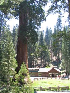
A beautiful Sequoia Tree


Before we could even enter the Visitor’s Center, we heard a Ranger talk on black bears. Apparently Sequoia is a great habitat for black bears, and if you’re lucky, you may even see one grazing in one of the meadows and not at your picnic table! We learned that they will break into your car, even with the windows all the way up, to get to any food you have. Bears can even recognize what a cooler looks like and break in to get to it. Did you know that black bears can smell food up to 5 miles away!? But they can’t hear worth a squat!

The park road is narrow, very curvy and steep, with many, many switchbacks. By some miracle Austin didn’t get car sick. Our original plan was to drive from the Foothills section where we entered all the way to the other end at General Grant Grove, to which Sue’s Frommer’s book said would take 2 hours. HA HA! There is no way, even if you didn’t stop, and even if you drive like Mike. We only made it 1/3 of the way, not even making it to the Lodgepole Visitor Center.

Our first stop was at a place called Hospital Rock. I don’t know the story behind it, but it had these red rock art pictures, the red paint probably symbolizing blood. Maybe they tended to the wounded under the rock overhang, either that or left them there to die!


Emma trying to find the deepest hole

Right across from Hospital Rock is a giant boulder with a bunch of holes in it that were used with a pestle to grind acorns into meal. We thought that was pretty cool.


This blue-green container is a bear trap, located in the Hospital Rock parking lot, along with a lot of warning signs about bears. Our bear talk this morning taught us to do the bear dance, that is, if one approaches, make lots of noise, stomp around and wave our arms while screaming. Sounds like Emma having Diva moment to me...(since she's had a few of those on this trip already, I don't anticpate that we'll have any problems with the bears).... Now her, on the other hand...maybe we can put her in there instead...

Continuing up the twisty road, we headed to the Giant Forest, checking out the museum and walking the Giant Tree Loop. At the beginning of the trail and right in front of the museum is a tree called The Sentinel. This thing is MONSTROUS, although according to the placard, is average for the giant Sequoias! The trees are so big and thick, that they don’t look real. The base of this tree is 21 feet wide, and it’s 278 feet tall. It’s estimated to be 2,000 years old.

The Tree Trail circles the Round Meadow, and walking this trail is simply magical. The trees are so amazingly beautiful. The older sequoia giants are scattered throughout the forest, with stands of 4 or 5 together every now and again. You can’t believe the wonderful smell, almost like a mixture of pine and cinnamon, with a hint of cedar. Sprinkled among the trees are boulders and fallen sequoias, and the meadow is filled with wildflowers and lined with soft ferns where little streams trickle in from the hills. I could just see myself living in this wonderful place, getting lost in the beauty everyday. It’s so peaceful, yet so awesome in its scale and presence. All of the world’s cares can’t help but fall away. It is by far my most favorite place so far.

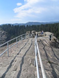
After making lunch, we headed to Moro Rock and climbed the 400 steps to the top of the granite dome. Emma only made it about 1/3 of the way, which is a good thing because I would have been a nervous wreck with her by the time we made it to the top. The view is beyond magnificent. I was so moved that it brought tears to my eyes (maybe the fear of heights had something to do with it…). I was so glad that Austin climbed back to the top with me and that we could share such an amazing experience together. The view is like a buffet for the eyes – snow capped mountain peaks, jagged rock formations, smooth boulders poking from rolling hills covered with green trees, and a valley with a river that flows out to infinity. Inspiring. I didn’t want to leave (maybe the fear of climbing down had something to do with that…).

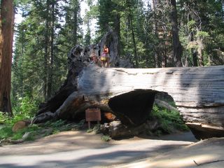
Making one last stop, we mugged at the kitschy tunnel log, a fallen

sequoia that you can drive through the width of (the kids were
disappointed at first because when I told them you could drive through it, they thought that meant you could drive down the hollow middle of it!)

It was a blissful 79 degrees on the top of the mountain. Placing our bets as to what the temp would be when we pulled into the hotel parking lot, we headed back down the forever long and winding road. Poor Mike, he was so mentally tired from driving this road. I said a silent “thank God” to myself that we didn’t stay into the evening hours.

Pulling into the hotel, the temp was 102 degrees at 6pm – Emma and Daddy tie for the answer. Argh! Pool, here we come. The water had to be 87 degrees, but at least if felt cool once we got out.

Friday, July 22, 2005

A view from inside a fallen Sequoia. The tree was hollowed out and used as a horse stable.
Two fawn and a mother while driving to Grant Grove.
Roaring River Falls, and it was roaring!
Family picture

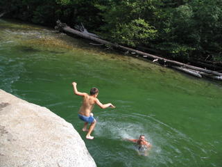
Swimming in Kings River, Kings Canyon NP


Austin braved the swift current and cold water to jump from Muir's Rock.

We found this spot unexpectedly, hence the lack of bathing suits as Austin and Mike swim in their skivvies, and Emma in Mike's t-shirt. I opted out of this adventure...
Grizzly Falls, Kings Canyon
This tree is the Sentinel, outside the museum
Hospital Rock
The roots of a fallen Sequoia.
A Giant Sequoia.
The walkway to the end of Moro Rock.
the Great Western Divide, Sierra Nevada Mountains.
Granite cliffs as taken from the very top of Moro Rock.
Austin and me on the top of Moro Rock. That is the Great Western Divide behind us with snow.
View of the granite cliffs while climbing to Moro Rock.
A toppled tree that you can drive through.
General Sherman Tree is the oldest living thing on the planet, estimated at between 2,800-3,000 years old, and still growing at an incredible rate.
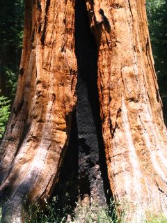
The black part is a scar from a fire. The tree will eventually grow around the scar.
Round Meadow
Giant Sequoia trees will grow around anything. Rocks can bee seen encased in the roots of trees tghat have toppled.

Thursday, July 21, 2005

Catching UP!

I'm trying to catch up my past posts, but having a problem because we only get to internet every 3-4 days. Therefore, I have to post pictures separate from the words for the sake of speed.

Today we are heading to Kings Canyon Park. Yesterday was Sequoia, and it was awesome! My favorite park so far. The weather is still unbelievably HOT! and we can't wait to hit San Fran where it will seem like Alaska in comparison, at 76 degrees high!

Hope all is well at home - we're on the home stretch now and missing everyone.

A Day on the Road

Tuesday, July 19, 2005 California, Here We Come

Not a very eventful day. We packed up yet again, and hit the road by 10 am.

I kept track of the temperatures along the way, watching them rise as we drove through the Mojave desert:

Kingsman Arizona –100 degrees at 1:28 pm. We stopped in this town of 20,000 in hopes of finding a hair salon, and bingo! Mike and I were able to walk in and get our hair cut! I haven’t been this elated since walking into the Safeway in Williams. Talking with my hairdresser, she said she couldn’t stand the humidity! I had to laugh out loud, she doesn’t know what humidity is!

Bullhead City – 115 degrees at 2:09 pm

Somewhere in California, just over the state line – 117 degrees at 2:20 pm. This is the all time high for our trip thus far!

Barstow – cooled down to a chilly 94 degrees at 4:10 pm! It was raining, and it smelled really funny.

We stopped at a rest stop that is right next to Edwards Air Force Base and the temp was 110 degrees. It was very breezy, but the “breeze” was so hot if felt like someone was pointing a giant hairdryer at you! Even the stainless steel walls in the bathroom here hot to the touch, and they didn’t even get direct sun.


This windmill farm is quite a site when you see it from the front. The windmills line the tops of the hills for miles.


Three Rivers is the name of the town we’re staying in right outside of Sequoia NP. This is a very pretty little town, nestled between some rolling hills (= winding roads) and a large lake. Pizza at the Pizza Factory for dinner is just what the Dr. ordered. We are still waiting for the temperatures to cool down, but it’s still 92 degrees and very humid at 10pm. I’m worried as to what the daylight temps will have to offer…

Reaching the Grand Canyon

Monday July 18, 2005 South Rim of the Grand Canyon

The KOA we’re at is about 40 miles north of the park, 6 miles north of Williams, so it’s a haul to get into the park. By the time we arrived around 8:30am, the crowds had already started. This by far has been the most crowded park that we’ve been too, but still not so crowded that you can’t walk the sidewalks or find a parking spot.

Grand Canyon Park has instituted the use of shuttle buses, and therefore you can only drive so far into the park, which although I understand the reasoning behind, is a major pain in the butt. Parking at Market Plaza, we hopped the shuttle to the brand new and beautiful Visitor’s Center. There is no movie to check out and we didn’t make it in time to start the 9:00 am Jr. Ranger program, so we opted instead to participate in the 4pm program, and planned our day accordingly.
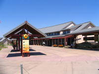
Walking from the Visitors Center to Mather Point, we walked the Rim Trail the .7 miles to the Yavapai Observation Station, stopping along the way for pictures and drinks. Emma was really dragging along, and it was only 10 am! (and here we thought the Canyon was going to be cooler, and it was still close to 100 degrees!)

Hot, sweaty and tired, we jumped on the shuttle to Grand Canyon Village, where we had an amazing lunch at The Bright Angel Lodge restaurant. From here, we walked the Rim Trial a little further, checking out a wonderful photography exhibit in the Kolb Studio. Picking up the red shuttle, we rode out to Hopi Point for a quick peek at the canyon before shuttling it back to the Shrine of the Ages for the 4pm Kids’ Ranger talk.

The kids learned about mountain lions in their kids Ranger talk, including the fact that when a lion kills a deer, it rips the stomach out and throws it 30 feet away. Yum… They got their books checked, said their pledge (which included using the bathroom before getting into the car!) and earned their 4th Jr. Ranger badge.

We got the heck out of Dodge, hot, tired, and yes, sweaty! Now, it takes a lot to get actually sweaty in this dry heat! Any moisture your body may have simply evaporates before it can even leave your body! It’s hot, but this hot is actually easier to handle than the 85 degrees and humid that were used to having in NY. I don’t think I would need a clothes dryer out here…

The kids really wanted to go swimming, and if it were up to them, we would spend the entire vacation in a pool. Heading back towards the KOA, we stopped at a kitchy roadside diner and campground based on the Flintstones and fashioned after Bedrock. What a rip this joint is; they wanted $20.00 just to walk through the “city” and go into all of the “Bedrock” buildings. Needless to say, we skipped that and just took the kids’ picture in the Flintstone car and camper out front!

Managing to put the kids off from swimming temporarily with the promise of an ice cream, we sailed past the KOA another 6 miles south to the town of Williams. I wanted to scope it out for gift shops, and a both Mike and I have been desperate to get our hair cut since we left Vegas (too much hair + desert heat = misery). Much to our glee, there was a Safeway grocery store there, which we promptly entered and felt like we were in Disneyworld. This is the biggest grocery store we’ve been in since we left the Super Walmart in Vegas. Who knew one could find so much pleasure from being able to choose from a selection of grocery items! One thing I noticed throughout our grocery store encounters, is even the smallest squat of a store has that Red Bull drink. Go figure, they don’t have minute rice, but they’ll have Red Bull – in two varieties! After loading up on water and comfort food items, we walked immediately to the Dairy Queen and had ice cream for dinner.

The town of Williams is on the old Route 66 loop. It’s a very cute little town, and Austin decided he really liked it. We all agreed it was just the right size – not too big and touristy, but not so small as to feel confined. The main “strip” has a nice easy feel, with eclectic shops and small town restaurants. The bonus was the amazing sunset we caught between the rolling hills. Jetting back to the KOA, the kids were able to swim for an hour before the pool closed.

To top off the night, I fired up the laptop and we started watching the Aviator out on the front porch of our little abode. Emma fell asleep on my lap.

Canyonlands - Needles District

Sunday July 17, 2005 Canyonlands Needles District

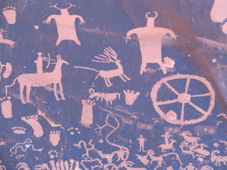
Packed up and said goodbye the Moab KOA and headed out to the Needles District of Canyonlands. On the way we stopped at Newspaper Rock, which is on the road that leads into the park’s south entrance. This is an area of rock where you could see petroglyphs that are estimated to be 2,000 years old. Petroglyphs differ from Rock Art, in that the symbols are “pecked” into the stone with another stone or tool and hammer, and Rock Art is painted onto the rock surface.

The road into the Needles District is very long, but the scenery is really different than most of the parks. One side of the road has high sheer cliffs that form a wide banded ridge. The texture of the rock reminds me of a cake that has been frosted in strokes from the bottom up.

The other side of the road has vast plains, with gigantic red sand dunes topped by a mesa and rock formations. As you travel further into the Needles, you get to the formations for which this section is named, that being the red and white striped fins, mushrooms, and needles. The only way to get closer to the needles is to take a 4x4 road or a very long hike.

We stopped in the Visitor’s Center to get our passport stamped and for the kids to hand in their Jr. Ranger booklets. The Ranger on duty asked them many questions about what they learned while in the park, and about why the National Parks must be protected. They received their 4th Jr. Ranger badge without much fanfare (as compared to other VC’s) and had to state the ways they were going to help protect the parks.

Now it was off to the short (.6 mile RT) Cave Spring Trail, which was really neat and featured an abandoned cowboy camp and a couple of examples of rock art under one of the rock overhangs. The trail also features two wooden ladders that you have to climb to get up on the top of the rocks. Even though it was hot, the kids agreed they liked this trail.

Driving to Big Spring Canyon Overlook, we soaked in the vistas before heading back out to the Pothole Point Trail. This trail takes you over slickrock that is pocked with depressions called potholes. There were thousands of potholes, and they were all dry. There was a wonderful breeze up on top of the rocks, and the views are amazing.

We don’t have Potholes like this in NY!! Potholes are formed because the rock erodes unevenly, and depressions are made by windblown sand grains and pebbles, which continue to scour the surface deeper. Rainwater collects and continues to dissolve the cementing material. In the early spring and late summer, rain fills the potholes and allows life to spring back. Eventually some potholes trap enough sand and organic matter to allow plant life to grow.

On the long drive to the South Rim we got to see Mexican Hat, which is a balancing boulder on top of a rock formation that resembles just that. The hills in the background were very pretty, with large wavy stripes of color.

Monument Valley offered some interesting views, and is used a lot for the background in many western movies. The day was really hazy, and a balmy 102 degrees, so some of the pictures will probably reflect that.

Rather than stop at the KOA, we shot straight to the Grand Canyon to check it out and catch the sunset. Managing to make it to the South Rim by 7 pm, we parked at the Desert View observation area which is the first area when coming in the park off of state road 64. Located at Desert View is a 70 ft. stone building called the Watchtower, which was designed by Mary Colter after the towers found at ancient pueblos such as Meda Verda and Hovenweep. Climbing to the top, we took in the views at the highest elevation point on the South Rim at 7, 522 feet. There were fires burning on the North Rim, and the smoke filled the whole canyon with a haze. Hopefully not all the detail of the canyon will be lost, but surely the panoramic vistas will look hazy.

Hopping in the car, we drove to Lipan Point, where we caught a glorious sunset, despite the smoke from the fires. The weather here is so much more reasonable, right around 86 degrees at 8pm. We may even be able to have a camp fire tomorrow night!

We finally rambled into the KOA around 10 pm. Another days travels over.

Finishing Arches, off to Canyonlands

Saturday, July 16 2005 Arches and Canyonlands

Headed out of the campground by 8:30, and it was already 83 degrees. After stopping at McD’s for brekky, (the first McD’s we saw since Vegas!) we made our way all the way through Arches to get to Devil’s Garden and to the Landscape Arch trailhead. It was very busy there, although there were still parking spots. Of all the parks we have been to so far, this trailhead certainly had the most people.

(An observation we’ve made on our trip, is that there is an overabundance of foreign travelers! As Americans, we seem to be in the minority, since according to my unofficial calculations, 1 in every 5-6 groups of people around us speak English! There seemed a lot of foreigners in Vegas, but it’s even more apparent at the parks. The trend seems to be to rent an RV. The whole row of RV’s next to us, are being commandeered by foreigners, the most seeming to be German. Mike calls it “European Row”. Must be the Euro is doing well against the dollar!)

Hitting the trail by 10 am, Emma tuckered out ¾ of the way. It’s only .5 miles one way and starts out in the shade. She managed to slog it to a shady spot and waited with Austin while Mike and I went a little further ahead to get a better view. Unfortunately you can’t walk under it, since they closed the trail in the 90’s due to a rock fall. The arch itself is said to be very unstable, and the passage of time can mean two things – that the arch is stable enough to walk under again, or that the stability is even less due to the continued exposure to the elements. Either way, the trail is still closed! The sign near the arch said that people were sitting under it when they heard cracking and popping. They ran for cover, and one person was able to actually get a picture of the rock falling from the right side of the arch.

Somehow I managed to get Emma back to the car, while Mike took one of the spurs to the Pine Tree Arch and the Tunnel Arch. Driving back to the Visitor’s Center, the kids handed in their Jr. Ranger booklets and received their bright and shining new Jr. Ranger Badges, the third of the badges earned. According to the kids, these are by far the best badges yet, since these badges boast a picture of Delicate Arch on them. They didn’t need to say an oath this time, but the Ranger did announce to everyone in the VC to congratulate the two newest Jr. Ranger members, to which Austin and Emma received much applause! This Jr. Ranger program is no small feat. The kids need to complete a certain number of activities in the booklet, based on their age. The activities are specific to the park, so you really need to either see the movie, or go on a Ranger guided activity visit the museum to get the answers. Some activities are easier than others, and they mainly reinforce the park rules, but others are more complicated like word jumbles and crosswords. The kids are even required to pick up trash along the paths, and a parent has to vouch by signing the booklet. The Jr. Ranger program has been my saving grace, as the kids are really learning a lot, and it gives them something to do in those small “down” times we have. Originally my idea was to have them write in a journal daily while we were on the road in order to keep up their skills, but this is working even better than that. They are so into it, and I quiz them on things they’ve learned. Emma is a maniac, wanting to finish every activity (there can be upwards of 10 in a book) and hand it in right away to get her next badge!

Stopping again only for a family picture in front of the Arches sign, we headed up the road to Canyonlands NP.

Canyonlands is divided into 3 separate sections like a pie, the Island in the Sky district in the North, the Needles district to the SE, and the Maze district in the SW.
Arriving at the Islands in the Sky VC by 1:00 pm, we caught the 15 minute movie, got the kids their Jr. Ranger workbooks, and were off to see the sights.

Our first stop was right across from the VC at the overlook there. The vista is incredible. I can see why Bubba loves this park so much, and I wonder if this is the spot where he called me to tell me he was standing on the edge of a 2,000 foot cliff when his cell phone died.

Traveling further south, we passed over the Neck (40 feet wide), through Grays Pasture to the Mesa Arch trailhead. In my opinion, Mesa Arch rivals any of those found in Arches. The walk to the arch is an easy one, through a pinyon-juniper woodland with lots of great examples of the cryptobiotic crust (aka: living soil - the kids could tell you what that is!). When you see the Mesa Arch from a distance it looks pretty cool, but once you’re right up to it and under it, you realize that you are on the side of a cliff and the view you get through the “window” of the arch is amazing. My heart was beating so quickly from the adrenaline, and I kept getting vertigo. The kids didn’t make me too nervous sitting near this arch, since the rocks form a pretty natural “safe” barrier. The kids had a great time exploring the nearby rocks. Since they were easier and safer to climb than the rocks at Arches, the kids were able to explore a little bit without mommy or daddy holding their hand. They were being good Jr. Rangers by staying on the trail and rocks, and being careful not to “Bust the Crust”.
Driving the road all the way out of the park, we stopped at a rock shop for the “free” dinosaur fossil that Austin wanted. The kids got a kick out of all the different kinds of rocks and various fossils, and all I kept thinking was that this is such a scam, being able to get people to actually pay money for rocks.

Being so tired and dusty and sweaty, yet again, we ambled back to the Ranch (KOA) so the kids could swim and I could shower. Neither Mike nor I were in any mood to cook in the 100 degree heat, so we headed out to Eddie McStiff’s for dinner, the incentive to eat there being the free wireless! While enjoying my two glasses of wine, I was able to make a few quick picture posts and added pictures to some previous.
In Moab, Arches National Park


Friday, July 15 2005 Moab – Arches National Park

Since we hadn’t eaten dinner until after 10 pm the night before, we let the kids sleep in and then took them to the pool, which didn’t open until 10 am. I caught up on the laundry while everyone else rested (look for the bags under my eyes in the pictures!).

The visitor center for Arches is in the process of being built, and it looks like it’s going to be beautiful, but for now it’s housed in a couple of mobile home trailers. We went in and watched the movie, and the kids got their booklets for the Jr. Ranger program. They didn’t have any special talks or walks for the Ranger program, so the movie would be the extent of it this time. The Ranger signed their books, making them official for the movie, and gave them a garbage bag, instructing them to pick up any garbage they see along the trails. The information board in the center was promising sun and 107 degrees, 20% chance of a thunderstorm! It was 11:30 and we were already roasting.

Driving the road gives you a lot of views of the arches and rock formations, so we did this most of the way. We parked at the Windows Section, where it was a short (but very hot) hike to North Window and South Window. Standing under the arch at North Window is amazing, and you can’t really comprehend the scope of its size until you’re standing right under it. Already the kids enjoy this park and the walks are worth it because they actually get to climb and stand under the arches.

Continuing on the loop, we climbed around Turret Arch.

Back in the car to cool down and have lunch, we moved the car around the loop and took the longer hike out to Double Arch, two arches formed by a giant pothole. While resting in the shade, a very young Park Ranger came along. Emma asked him if she could take his picture, which I thought was very sweet since it was the last one on her camera and she had wanted to save it. I took her picture with Ranger Robert Wallace, and he let her wear his official Ranger hat. On the way to Double Arch there are some interesting rock formations - like the Parade of Elephants.

Emma and I thought this rock looks like a person, although it’s not named anything special, that we know of.

Continuing down the main road, we took the turn-off for Delicate Arch. We were so hot and tired, and the hike out to this arch is 3 miles round trip, that the observation viewpoint off the parking lot would have to do. Delicate Arch is unusual in that it runs vertically up the side of the rock, and it’s pretty much all by itself out there, accompanied by only a few smaller rock piles nearby. It looks like it’s going to tip over.

We finished driving the whole park, ending in Devil’s Garden and checking out where we would have to take the trail to Landscape Arch. The Ranger said it would be a good hike for the kids, as it passes through some narrow fins and is in the shade. We will do that first thing tomorrow, before it gets too hot. Landscape Arch is in a very delicate place, as the Rangers feel it could break at any time.

Sunday, July 17, 2005

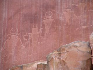
1,000 year old Petroyglyphs at Capitol Reef

We drove the outskirts of Capitol Reef, and thought it was very magical. The rocks are extremely red. The visitor Center was closed, so we couldn’t get our passport stamped, but we decided if we ever came out this way again, we would certainly check out this park.

Saturday, July 16, 2005

Deer walking right next to the road in Capitol Reef.

Mike started tweaking when he saw these two big Mule Deer bucks walking along the side of the road.
Sheer Rock cliff near the Petroglyphs.
Capitol Reef. The Visitor's Center was closed.
Fins of Devil's Garden, Arches
Hoodoo at Bryce Canyon
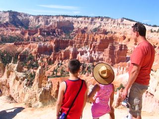
Overlooking Bryce Canyon Amphitheater
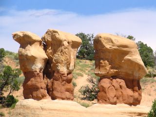
Devil's Rock Garden, on Hole in the Rock Road, Grand Staircase, Escalante Park
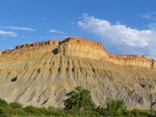
Capitol Reef Park, on the way out.
Delicate Arch, as taken from the viewpoint.
Double Arch. Notice the tiny person at the bottom of the picture, and you can get a sense of how big this really is.
Parade of the Elephants, on the hike to Double Arch, Arches
North and South Windows, from Turret Arch